Budapest, Hungary, 29-31.05.2013
| Report on the Symposium of the IAG Subcommission for Europe (EUREF) held in Budapest, Hungary, 29 - 31 May 2013 |
|---|
| Opening Session Chair: Ambrus Kenyeres click to see participant list |
| Welcome by State Secretary, Ministry of Rural Development G. Poprády |
| Welcome by Director General, Institute of Geodesy, Cartography and Remote Sensing B. Toronyi |
| Welcome by the President IAG sub-commission 1.3 "Regional Reference Frames" J. Torres |
| Welcome by the Chairman of IAG sub-commission 1.3a "European Reference Frames" J. Ihde click to see file |
| Welcome by the Secretary of IAG sub-commission 1.3a "European Reference Frames" A. Caporali click to see file |
| The activities of the EUREF Technical Working Group C. Bruyninx click to see file |
| Session 1 GNSS Now - Bigger, Better, Faster Chairs: Rolf Dach, Wolfgang Söhne |
| 1.1 - Real-Time and Multi-GNSS - Key Projects of the International GNSS Service (invited) U. Hugentobler click to see file |
| 1.2 - Experiences with IGS MGEX data analysis at CODE L- Prangue click to see file |
| 1.3 - The EUREF Permanent Network (EPN): Status and Strategy C. Bruyninx click to see file | click to see file |
| 1.4 - Benefits of double stations in permanent GNSS networks E. Brockmann click to see file |
| 1.5 - Update of EUREF GNSS Analysis to Bernese SW V5.2: New Features and Impact on Results S. Schaer click to see file |
| 1.6 - Integer Ambiguity Resolution for Precise Point Positioning (invited) P. Henkel click to see file |
| 1.7 - Real-Time applications of the International GNSS Service (IGS) Multi-GNSS Experiment (MGEX) – initial Galileo results W. Söhne click to see file |
| 1.8 - Analysis of the transformed clocks approach for dealing with scale-induced bias in the generation of ETRS89 clock and orbit corrections to broadcast ephemeris L. Huisman click to see file |
| 1.9 - Exploitation of the new IGS Real-Time Products for GNSS Meteorology R. Pacione click to see file |
| 1.10 - Alberding GNSS data management & monitoring tools (Commercial) T. Horváth click to see file |
| Session 2 GNSS for Earth Sciences Chairs: Carine Bruyninx, Rosa Pacione |
| 2.1 - On the impact of ground-based GNSS data in European meteorology (invited) H. Vedel click to see file |
| 2.2 - COST ES1206: Advanced GNSS Tropospheric Products for Monitoring Extreme Weather Events and Climate J. Jones click to see file |
| 2.3 - Advanced GNSS troposphere products for monitoring severe weather events and climate - plan of Polish participation in COST ES1206 J. Bosy click to see file |
| 2.4 - The New Leica GNSS Reference Server GR25 (commercial) N. Demoegen |
| 2.5 - Joining efforts and creating opportunities toward an effective integration of GNSS data in Europe: the EPOS vision and strategic approach (invited) D. Bailo click to see file |
| 2.6 - Geodesy in EPOS - a status report M. Lidberg click to see file |
| 2.7 - Modeling surface GPS velocities in the Southern and Eastern Alps by finite dislocations at crustal deformation A. Caporali click to see file |
| 2.8 - Recent Crustal Deformation and Seismicity in Southern Bavaria revealed by GNSS observations C. Voelksen click to see file |
| 2.9 - Optimization of data exchange and energy consumption for dense networks of GPS receivers L. Benoit click to see file |
| Session 3 ETRS89: Present and Future Chairs: Ambrus Kenyeres, Martin Lidberg |
| 3.1 - Preparation for the ITRF2013 (invited) Z. Altamimi click to see file |
| 3.2 - EPN Densification Based on the Integration of the National Active GNSS Networks A. Kenyeres click to see file |
| 3.3 - First steps and tests in the development of an EUREF Velocity Model H. Steffen click to see file |
| 3.4 - Towards a Dense Velocity Field for Central Europe A. Caporali click to see file |
| 3.5 - Dealing with significant differential tectonic plate velocities within an RTK-network: The case of HEPOS M. Gianniou click to see file | click to see file |
| 3.6 - New results of the velocity field in Greece by an automatic process of a permanent GPS network M. Chatzinikos click to see file |
| 3.7 - Deformation Field Analysis with Least Squares (LS) Using very high resolution satellite Images Correlatio N. Khelofi |
| Session 4 Development of ETRS89 and EVRS for Geo-information Applications Chair: Elmar Brockmann |
| 4.1 - Initiative European Legislation and programmes relevant to Geodesy (invited) D. Lovell click to see file |
| 4.2 - Theoretical and practical aspects of realization of ETRS89 in Poland M. Ryczywolski click to see file |
| 4.3 - Extensions and Upgrades of ETRF2000 in Italy A. Caporali click to see file |
| Session 5 Height and Gravity Chair: Markku Poutanen |
| 5.1 - Validation and Unification of national height reference frames in Europe (invited) G. Liebsch click to see file |
| 5.2 - Modernization of the German height reference frame – first results M. Sacher click to see file |
| 5.3 - Height and gravity changes due to glacial isostatic adjustment H. Steffen click to see file |
| 5.4 - The effect of the anomalous gravity field on horizontal coordinate G. Papp click to see file |
| 5.5 - A combined geoid model for Hungary based on the spectral properties of gravity related data E. Szücs click to see file |
| Session 6 National Reports Chair: Gunter Stangl, Jan Krynski |
| 6.01 - National Report of Austria N. Höggerl, E. Imrek, D. Ruess, G. Stangl, E. Zahn, H.-P. Ranne click to see file | click to see file |
| 6.02 - National Report of Belgium P. Voet et al. click to see file | click to see file |
| 6.03 - National Report of Croatia M. Marjanovic, M. Premuzic, M. Ciprija click to see file |
| 6.04 - National Report of the Czech Republic J. Simek et al. click to see file |
| 6.05 - National Report of Denmark K. Keller, M. Weber click to see file |
| 6.06 - National Report of Estonia P. Pihlak et al. click to see file | click to see file |
| 6.07 - National Report of Finland P. Häkli et al. click to see file |
| 6.08 - National Report of France A. Duret click to see file |
| 6.09 - National Report of Georgia G. Hahubia click to see file |
| 6.10 - National Report of Germany J. Ihde, C.-H. Jahn click to see file |
| 6.11 - National Report of Great Britain M. Greaves click to see file | click to see file |
| 6.12 - National Report of Greece M. Gianniou, D. Mastoris click to see file | click to see file |
| 6.13 - National Report of Hungary P. Braunmmülle click to see file |
| 6.14 - National Report of Ireland C. Bruton click to see file |
| 6.15 - National Report of Italy L. Baroni click to see file |
| 6.16 - National Report of Latvia I. Aleksejenko click to see file |
| 6.17 - National Report of Lithuania E. Parseliunas, T. Ladukas, J. Spuraite, J. Kalantaite, D. Slikas, A. Buga click to see file |
| 6.18 - National Report of Macedonia B. Stojanovska click to see file |
| 6.19 - National Report of the Netherlands L. Huisman, R. Broekman, H. van der Marel click to see file |
| 6.20 - National Report of Northern Ireland G. Bell, P. Downie click to see file |
| 6.21 - National Report of Norway O. Vestol click to see file |
| 6.22 - National Report of Poland J. Krynski, J.B. Rogowski click to see file | click to see file |
| 6.23 - National Report of Slovakia B. Droscak, D. Ferianc, E. Benova, M. Rohacek click to see file |
| 6.24 - National Report of Slovenia K. Medved, S. Berk, B. Stopar click to see file | click to see file |
| 6.25 - National Report of Spain A. Barbadillo, M.A. Cano, P. Gonzalo, J.A. Sanchez, M. Valdés click to see file |
| 6.26 - National Report of Sweden C. Kempe et al. click to see file | click to see file |
| 6.27 - National Report of Switzerland E. Brockmann, D. Ineichen, M. Kistler, U. Marti, S. Schaer click to see file |
| 6.28 - National Report of Turkey A. Cingöz click to see file |
| Closing Session Chair: João Agria Torres |
| Resolutions click to see file |
| Poster Presentations |
| 01.01 - New RINEX file monitoring at CODE S. Lutz click to see file |
| P.01.02 - ANUBIS - Tool for monitoring and manipulating multi-GNSS observation and navigation data P. Václavovic click to see file |
| P.02.01 - E-GVAP-III H. Vedel click to see file |
| P.02.02 - Assessment of Strategies for Spatial Atmospheric Parameter Interpolations E. Michal click to see file |
| P.03.01 - Estimation of the influence of ASG-EUPOS stations coordinates stability on the ETRS89 realization K. Szafranek |
| P.03.02 - Coordinate monitoring system of Polish permanent networks A. Araszkiewicz |
| P.03.03 - Updating the geodetic frame for local static and dynamic GNSS networks in central Italy F. Radicioni |
| P.03.04 - Comparision of intraplate strains measured by GPS with the local strain rates measured by quartz-tube extensometers in the Sopronbánfalva, Pécs and Bakonya observatories, Hungary G. Mentes |
| P.04.01 - Geodetic-Geophysical Observatory Borowa Gora as an external data source in the European Project "Public digital geo-information resources - OGNIWO" A. Moscicka |
| P.05.01 - The geoid in the area of Brunei and its relation with the local vertical datum A. Liszwitz |
| P.05.02 - The GRACE signal correlation, strength reduction and modification as a result of a raw signal filtering with tropic and anisotropic filter M. Birylo |
| P.05.03 - Evaluation of Estonian Geoid models using new GPS-levelling data H. Jürgenson |
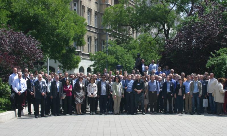
Photos